
Independence Neighbors by Public Source
A block search begins with geography. LINK-GIS and the Kenton County land map show which parcels actually touch or face one another. PVA records add the assessed owner and parcel facts. Deeds and plats confirm legal transfers or subdivision lines. The remaining sources answer narrower questions and have firm limits, especially voter products and private group rosters.
| Source | What It Shows About a Block | Access |
|---|---|---|
| LINK-GIS and Kenton GIS | Adjacent parcels, roads, buildings, zoning, voting and flood layers | Free map browsing, selection, measurement and print tools |
| Kenton PVA | Owner, situs, mailing address and assessment for one parcel | Free basic search; parcel record, not household roster |
| Clerk deeds and plats | Transfers, subdivision facts and shared legal boundaries | KCOR online or courthouse record room |
| SBE voter products | Limited street or household labels for authorized users | Restricted SBE-84 process; no general block search |
| City civic pages | Courthouse Square, public boards, events and district context | Public pages and minutes; no household membership list |
| Library directories | Historical occupants, businesses and newspaper notices | Library or digital volume; coverage varies by year |
| Chamber directory | Member organizations filtered by category or ZIP | Free business directory, not proof of residence |
The owner name is evidence of an interest in the parcel on the record date. It does not prove occupancy. A mailing address may belong outside Independence, and parcels may be vacant, institutional, agricultural, or held by an entity. Use “neighboring parcel owner” when that is all the source establishes. Reserve “resident” for a source and date that support residence.
Click Parcels Around Independence Neighbors
The LINK-GIS viewer supports an address, PIDN, or owner search and offers parcel, building, road, aerial, zoning, flood, voting, city-boundary, and development layers. Search the target address, turn on parcel outlines and address points, and zoom until lot lines are clear. Then click parcels that share a line or frontage. A road, creek, rail line, or common tract may separate lots that look close on screen.
A popup may show PIDN, owner, address, land use, assessed value, class, legal description, and subdivision details. Map data is supplied “as is” and is not a survey. Confirm a disputed boundary with the County Clerk, PVA, plat, or survey rather than reading precision into a screen line.
Note: Map adjacency is a land relationship, while neighbor identity and household membership require different evidence.
Map Independence Neighbors Outward
Build a small, dated parcel log rather than copying names into a loose list. The process stays defensible and makes gaps visible:
- Locate the known address in LINK-GIS or the Kenton Land Records Map.
- Click each adjoining or facing parcel and save its PIDN and situs address.
- Open the PVA search for each PIDN and note the record date, owner, mailing address, and parcel class.
- Use a deed or plat when ownership or a shared boundary needs formal confirmation.
- Label vacant, entity-owned, institutional, and separated parcels accurately.
For a long run of addresses, the Independence street directory handles the full named-street chain. A neighbor search should remain focused on the immediate block or radius.
Independence Neighbor Voter Limits
Kentucky's ordinary Voter Information Center asks for a legal first name, last name, date of birth, and an optional last four digits of a Social Security number. It checks one voter's registration, polling place, and absentee status. It does not accept a street or ZIP as a public reverse-neighbor search.
Some street-order and household-by-street or ZIP products exist under 31 KAR 3:010, but SBE-84 limits full voter-data distribution to qualified candidates, political parties, and issue committees. Authorized products may include name, address, age code, party, gender, ZIP, and participation history. Participation says only whether someone voted, never how. Social Security numbers, email, and protected data stay withheld.
Key limit. The existence of an authorized street-order product does not create a public block roster for ordinary Independence neighbor research.
Independence Courthouse Neighbor Network
Independence has no official citywide HOA or neighborhood-association directory in the research. Courthouse Square is the strongest public civic layer. City newsletters describe Downtown Independence around Madison Pike and McCullum, the DI zone, preservation work, the farmers' market, and historic groups. These sources show public activity and place history, not everyone who belongs to a household.
Independence Fire District Board
Public meetings, appointed board members, and district governance offer geographic and civic context. The county page lists meetings at Station 1.
Independence Business Association
A regional guide lists this civic and business group at PO Box 694, Independence, KY 41051. No complete public member roll was located.
Northern Kentucky Chamber
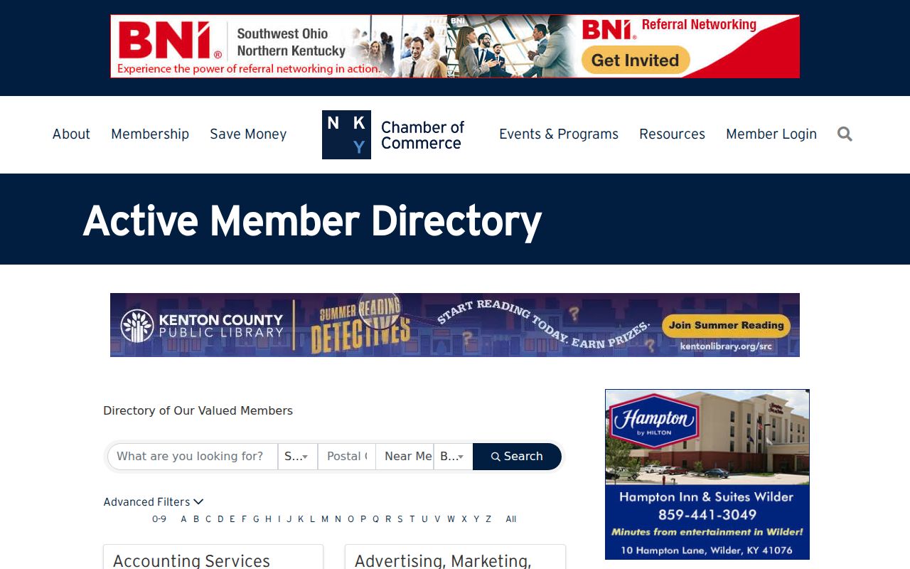
Its member directory filters organizations by keyword, category, postal code, or alphabet. Membership is not household evidence.
National Night Out notices and city board pages can identify groups or officials active at a fixed time. Use names only in the public role shown. Private membership should never be inferred from event attendance.
Search Independence Neighbor Organizations
The Northern Kentucky Chamber organization directory is a useful public-business layer for Independence and nearby communities.
Church registers, school yearbooks, cemetery records, and club material belong to the historical layer. Kenton Library's GenKY, church microfilm, and vertical files may connect families across time. No current public Independence-wide congregation, club, neighborhood-watch, or HOA membership database was located. That absence must remain a limit, not an invitation to infer names.
Independence Records Beat Neighbor Tools
Commercial neighbor tools combine sources with different dates and rules. They can be stale or attach a person to the wrong unit. Official sources are narrower, but they disclose their purpose and custodian.
| Method | Strength | Limit |
|---|---|---|
| GIS plus PVA | Direct parcel and assessed-owner relationship | Does not list all occupants |
| Deed or plat | Recorded transfer or legal boundary | May be older than present conditions |
| Public civic directory | Organization and public-role context | Not a private member or resident roll |
| Commercial compilation | Broad hints from mixed sources | Unverified dates, identity, and occupancy |
The right label matters. Say “parcel owner,” “public board member,” or “member organization” rather than converting every result into a claim about your neighbors.
Independence Neighbor Name Clues
The Kentucky Treasury unclaimed-property search accepts owner or business names and city clues.
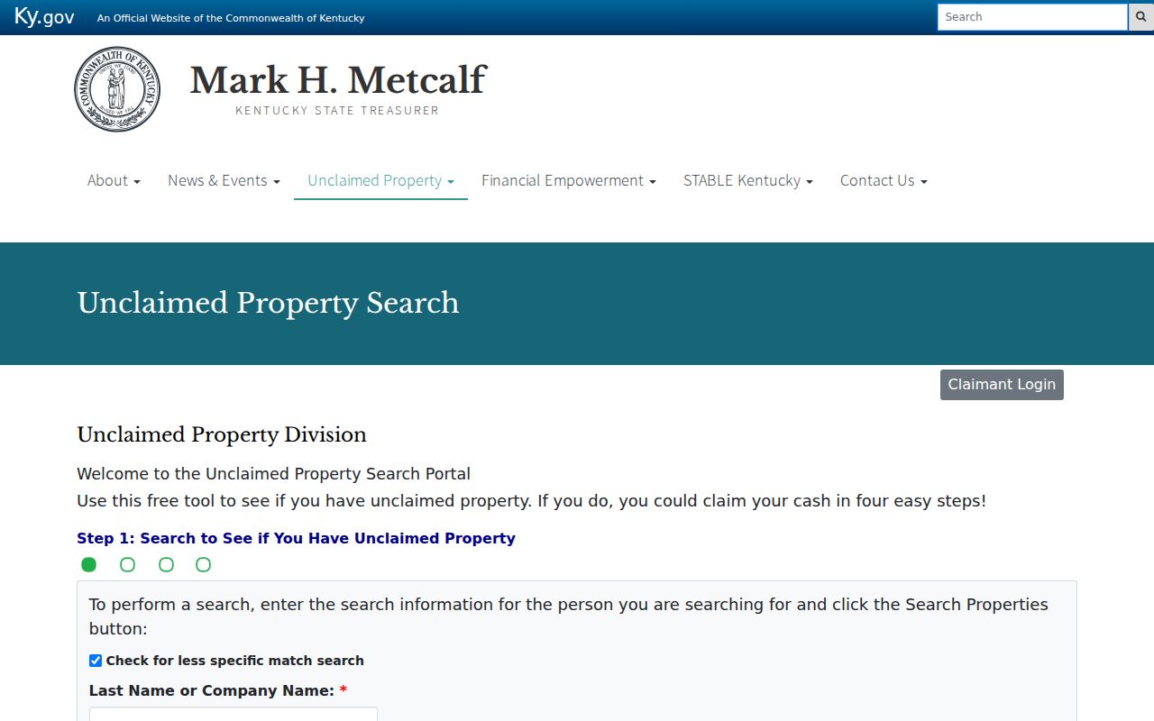
The Treasury warns that searches and claims do not require payment or card details. Use the official portal to avoid a scam, and verify any apparent match through the claim process. Never treat an old owner address or city label as current residence.
Independence Neighbors Across Time
A present-day parcel map is only one snapshot of an Independence block. The city expanded through major annexations from the 1960s through 1984. Cherokee, Beechgrove, and land west toward the Boone County line may appear under an older settlement, rural route, or county label in earlier records. Madison Pike also appears as Independence Turnpike, Independence-Colemansville Pike, State Road, and Main Street. Save every version of a road or community name before searching a historical directory.
The Kenton Library's regional city directories can place named occupants and businesses in street order, but Independence coverage varies from volume to volume. Census schedules through 1950 add households and nearby families as they stood on one enumeration date. Newspapers may report a block event, civic meeting, death, move, or business opening. None should be read as a current roster.
For older community ties, use the Kenton Library genealogy resources, then compare the printed address with a deed, parcel description, road intersection, or map. A surname repeated on the same page can suggest proximity. It cannot establish a modern neighbor relationship without later evidence.
Note: Historic neighbors belong to a dated source and address label, not automatically to today's street number or city boundary.
New Independence Block Records
A planned county park near Lincoln Ridge and the former Fox Run Golf Course shows how neighborhood records develop in real time. Kenton County describes a 225-acre project with civic, adventure, and trail ridges, about 70 percent untouched green space, and construction expected to begin late in 2026. The project does not identify private households, but it can change the public record around nearby parcels, roads, and civic activity.
Track official fiscal-court agendas, contracts, public meeting notices, park maps, and planning or permit records. LINK-GIS development layers may help place a project in relation to parcels, while city and county newsletters preserve the date and public description. Record the publication date because a proposal, approved contract, active permit, and completed improvement describe different stages.
This is a sound way to understand an Independence neighborhood without compiling personal profiles. Public projects explain why roads, access points, zoning layers, or parcel configurations may change. They also identify the government body responsible for a decision. If an online portal lacks the needed document, submit a focused request under the Kentucky Open Records Act process with the project name, date range, record type, and department. Kentucky's response schedule is five business days, though an agency may explain why more time is needed.
Protect Independence Neighbors' Privacy
Public parcel rolls omit renters and many household members. Utility subscriber data and DMV addresses are not resident-directory sources. Sealed or expunged cases stay unavailable. Kentucky Safe at Home participants use substitute addresses, and their actual address is exempt under state law. Private association rosters remain private unless the group chooses a public organizational listing.
Maps can also mislead. A mailing address does not prove occupancy, a ZIP does not prove city limits, and a building footprint does not show the people inside. Date every result and stop at the public boundary.
Lawful use. Use Independence neighbor records for civic awareness, reconnecting, or personal safety. Never watch, intimidate, stalk, or harass anyone.